
Database on Volcanic Hazard Maps and Reference Material(1983-)
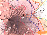
Volcanic Hazard Maps

Information
Materials
- List of local disaster mitigation plans, etc. (Japanese only)
- List of volcanic disaster prevention plans, emergency sabo plans for mitigating volcanic eruption disasters (Japanese only)
- Contents of "Volcanic Hazard Maps of Japan, Second Edition"
Links
- Japan Meteorological Agency (JMA)
- Ministry of Land, Infrastructure, Transport and Tourism (MLIT)
- National Research Institute for Earth Science and Disaster Prevention (NIED)
- Geospatial Information Authority of Japan (GSI)
- Japan Coast Guard
- Fire and Disaster Management Agency (FDMA)
- Geological Survey of Japan (GSJ)/ National Institute of Advanced Industrial Science and Technology (AIST)
- Volcanological Society of Japan
What's New
- Update; Usuzan No15, 15usu_1m02, Iwatesan No27, 27iwate_2h02, Chokaisan No29, 29chokai_2h01, Miyakejima No.62, 62miyake_1h04. 27 Sep. 2016
- Update; Asama No147, 45asama_1h01. 17 Sep. 2015
- We have changed the URL of Tokachidake No.10, Kamifurano town in the list of local disaster plans. 5 Nov. 2014
- We have redesigned our website. Added new data, i.e. 56 maps and 27 materials, volcanic disaster prevention plans, emergency sabo plans for mitigating volcanic eruption disasters, KML Network Link. 19 Jul. 2013
- “Volcanic Hazard Maps in Japan, Second Edition (with DVD-ROMs)” is published as the Technical note No. 380 of the National Research Institute for Earth Science and Disaster Prevention, Japan. 19 Jul. 2013
- Update history
Sakurajima and the innermost part of Kagoshima Bay (taken by Minami-Nippon Shimbun on 22 April 2013)
